Yes, you can use completely legal and FREE mapping on your Garmin Edge 800. Welcome to the OpenStreetMap, completely free maps for your GPS!  The basic version of the Garmin Edge 800 comes supplied with a “basemap” which isn’t much use at all. It contains a basic routable map of major roads, but lacks detail. If you’ve got the money, there are excellent commercial products you can buy – either the Garmin City Navigator maps, or the Ordnance Survey Discoverer series. Both are excellent, high quality, routable maps. See some screenshot comparisons here. But – if you don’t want to pay for mapping, you don’t have to, thanks to the amazing open source project OpenStreetMap.
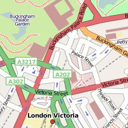 OpenStreetMap is a free worldwide map, created by people like you. The data is free to download and use under its open license.
Not only is OpenStreetMap data free to use and share, always being updated by the community, so in theory it should be more up to date and accurate than commercial products.
So, how do you get the OSM data on to your Garmin?
There are two main methods, one is quick and simple and the other is a bit geeky. Quick and simple method – follow my tutorial here for downloading the talkytoaster map
Geeky method – follow the guide here to roll your own .img file using various java programs to process raw OSM data. A bit complicated for most people! Wherever you are, there’s a free OSM garmin map for every part of the world. Find a big list of free Garmin OSM maps here.
Other useful links:
http://www.cyclestreets.net/ – Cycling intelligence for the UK, all based on OSM data
http://wiki.openstreetmap.org/wiki/Potlatch_2 – Wiki for Potlatch2 – the editor which lets anyone contribute updates to the OSM map.
Velomap, an alternative to TalkyToaster also contains some very helpful tutorials about making your own garmin .img files from the basic OSM data.
I live in the UK with a road bike. So I was looking for an up to date OSM map that included UK cycle routes and good UK routing.
Talkytoaster, looked great, but didn’t include UK Cycle paths/ways.
Velomap – included some UK cycle paths but I found the routing to be questionable. (I think I read on other forms that it doesn’t route well in the UK.
The Raven maps – haven’t been updated in years.
So I decided to follow the OSM wiki and create their map with a UK Cycle included. It can be complicated to create your own map, so I thought I would publish them (free too).
So if you want a OSM map including the UK Cycle Routes for your Garmin then download from here:
https://sites.google.com/site/openstreetmapgarmincycleuk/
It is basically the OSM map with the “Cycle layer”
I have found it the best for me.
+1 for Velomap
Pros: Easy, good tutorials (easy and advanced), frequent updated, customized maps, etc….
Hey great site and really useful. I’ve just ordered a Edge Touring and whilst it is out for delivery i’d thought i’d just check if this OSM tip is applicable. As far as i’m aware it has a full set of EU maps so do you know if I need to look to update or swap for OSM?
great post, but is there an equivalent for the Edge 500/510?
How do I download and install Open Source GPS maps on my Garmin Nuvi 2455?